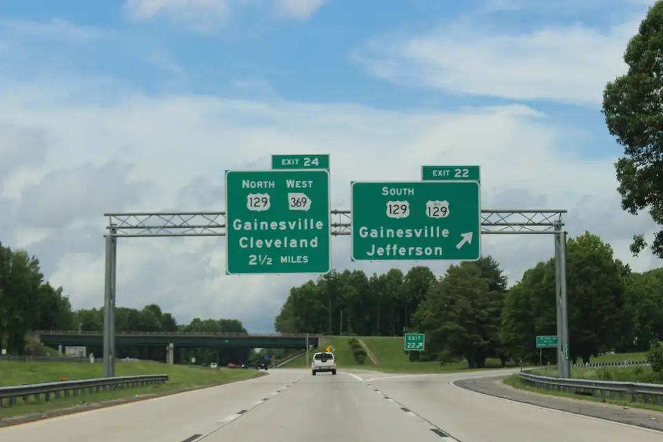
I-985 and GA 365 are one road with two characters. I-985 begins at I-85 Exit 113 in Gwinnett County (OpenStreetMap) and runs through Hall County with interchanges at Exits 8, 12, 14, 16, 17, 20, 22 and 24. North of Exit 24, the northbound ramps are signed US 23 North / GA 365 North toward Clarkesville and Cornelia (OpenStreetMap), and the crossings change: GA 365 at White Sulphur Road is a signalized at-grade intersection, not an interchange (OpenStreetMap). The Greater Hall Chamber lists direct access to I-985/GA 365 among the county’s main arteries (Greater Hall Chamber). Which side fits depends on your use, and the measurable differences are below. We make no claims about rents, prices or demand.
The interchanges, exit by exit
| I-985 exit | Crossroad | Jurisdiction at the interchange |
|---|---|---|
| 8 | GA 347 (Friendship Road / Lanier Islands Parkway) | Unincorporated Hall County |
| 12 | Spout Springs Road | City of Flowery Branch |
| 14 | H.F. Reed Industrial Parkway (west) / Martin Road (east) | Unincorporated Hall County |
| 16 | GA 53 (Mundy Mill Road) | Unincorporated Hall County |
| 17 | GA 13 (Atlanta Highway) and GA 53 | City of Gainesville |
| 20 | GA 60 / GA 53 Connector (Candler Road / Queen City Parkway) | City of Gainesville |
| 22 | US 129 / US 129 Business (E. E. Butler Parkway / Athens Highway) | City of Gainesville |
| 24 | US 129 North / GA 369 (Jesse Jewell Parkway / Limestone Parkway) | Unincorporated Hall County |
Crossroads come from OpenStreetMap ramp and signage tags, for example at Exit 14 and Exit 24; jurisdiction is the city limit at the interchange point on OpenStreetMap, not at any parcel near it. For Exit 14, the Gainesville Times reported its bridge opened to traffic on January 30, 2020 (Gainesville Times). On GA 365, the crossings at White Sulphur Road, Cagle Road, GA 52, Ramsey Road and Lanier Tech Drive are intersections. Do not plan a truck route around an exit that does not exist.
How the corridors scored
Our Corridor Fit tool tests each corridor’s center against measured, straight-line distances on OpenStreetMap data: an I-985 interchange within 2 miles, rail track mapped nearby, the Inland Port within 5 miles, at least 150 acres of mapped industrial land, and I-85 within 15 miles of the I-985 junction. Here are the six corridors on the I-985 and GA 365 spine:
| Corridor | Interchange | Rail | Inland Port | Industrial land | I-85 | Center governed by |
|---|---|---|---|---|---|---|
| Flowery Branch (Exits 12 to 14) | Pass: 0.4 mi to Exit 14 | Pass: Norfolk Southern within 2.2 mi | Fail: 13.6 mi | Pass: about 558 acres | Pass: 12.9 mi | City of Flowery Branch |
| Oakwood (Exits 16 and 17) | Pass: 0.9 mi to Exit 16 | Pass: Norfolk Southern within 1.6 mi | Fail: 11.1 mi | Pass: about 185 acres | Fail: 15.4 mi | City of Oakwood |
| Airport and Exit 20 | Pass: 0.8 mi to Exit 20 | Pass: Norfolk Southern and CSX within 1.2 mi | Fail: 6.9 mi | Pass: about 531 acres | Fail: 19.6 mi | City of Gainesville |
| I-985 north end (Exits 22 and 24) | Pass: 1.1 mi to Exit 24 | Pass: Norfolk Southern and CSX within 1.6 mi | Pass: 4.0 mi | Pass: about 336 acres | Fail: 22.4 mi | Unincorporated Hall County |
| GA 365 and the Inland Port | Fail: 2.9 mi to Exit 24 | Pass: Norfolk Southern within 1.9 mi | Pass: at the port | Pass: about 430 acres | Fail: 26.5 mi | Unincorporated Hall County |
| Lula and Clermont (GA 365 north) | Fail: 7.6 mi to Exit 24 | Pass: Norfolk Southern within 3.1 mi | Fail: 5.0 mi | Fail: about 42 acres | Fail: 31.1 mi | Unincorporated Hall County |
What the pattern says
South I-985 points to I-85. The Flowery Branch corridor is the only one on this spine within 15 miles of the I-985 junction, and it passes four of five tests. It loses only on port distance.
The port pulls north. Distance to the Inland Port shrinks as you go up the road, from 13.6 miles at Flowery Branch to the terminal itself on White Sulphur Road. In the tool’s warehouse preset (interchange, port and industrial land), only one of all twelve corridors passes all three: the I-985 north end around Exits 22 and 24.
GA 365 trades the interchange for the port. The GA 365 and Inland Port corridor sits at the terminal with Norfolk Southern track and about 430 mapped acres of industrial land, but its center is 2.9 miles straight-line from the nearest I-985 interchange, and its GA 365 crossings are signalized.
Manufacturing has the most options. The manufacturing preset (interchange, rail and industrial land) is passed by all four I-985 corridors in the table.
Who governs each side
The jurisdiction column matters as much as the distances. The GA 365 corridor and the I-985 north end are centered in unincorporated Hall County, where rezonings now go to the reinstated Planning Commission before the Board of Commissioners decides. The south end runs through Oakwood and Flowery Branch, each with its own process: the Oakwood Planning Commission meets at 6 p.m. on the second Thursday of each month (City of Oakwood), and the Flowery Branch City Council meets on the 1st and 3rd Thursdays at 6 p.m. (City of Flowery Branch). We do not name Oakwood or Flowery Branch zoning districts because their codes could not be read at the source; ask each city directly.
Corridor 01
Flowery Branch (Exits 12 to 14)
Governed by: City of Flowery Branch, City of Oakwood, Unincorporated Hall County
Flowery Branch and the Exit 12 to 14 area (Spout Springs Road, Martin Road and H.F. Reed Industrial Parkway), where the Falcons headquarters sits.
- I-985 interchange: 0.4 mi to I-985 Exit 14
- Rail: Norfolk Southern track mapped within 2.2 mi
- Inland Port: 13.6 mi to the Inland Port
- Industrial land: about 558 acres of mapped industrial land
- I-85: 12.9 mi to I-85 (at I-985)
- Airport: 6.7 mi to Lee Gilmer airport
- Hospital: 6.0 mi to NGMC Braselton
- Downtown: 8.5 mi to the downtown square
- City: City of Flowery Branch
Corridor 02
I-985 north end (Exits 22 and 24)
Governed by: City of Gainesville, Unincorporated Hall County
Where I-985 ends and GA 365 begins, around Exits 22 and 24 (US 129, Jesse Jewell Parkway and Limestone Parkway).
- I-985 interchange: 1.1 mi to I-985 Exit 24
- Rail: Norfolk Southern and CSX track mapped within 1.6 mi
- Inland Port: 4.0 mi to the Inland Port
- Industrial land: about 336 acres of mapped industrial land
- I-85: 22.4 mi to I-85 (at I-985)
- Airport: 2.9 mi to Lee Gilmer airport
- Hospital: 0.8 mi to NGMC Gainesville
- Downtown: 1.5 mi to the downtown square
- City: Unincorporated Hall County
Corridor 03
GA 365 and the Inland Port
Governed by: City of Gainesville, Unincorporated Hall County
White Sulphur Road and the Gainesville Inland Port off GA 365, with Gateway Industrial Centre and the Norfolk Southern line.
- I-985 interchange: 2.9 mi to I-985 Exit 24
- Rail: Norfolk Southern track mapped within 1.9 mi
- Inland Port: At the Inland Port (White Sulphur Rd)
- Industrial land: about 430 acres of mapped industrial land
- I-85: 26.5 mi to I-85 (at I-985)
- Airport: 6.9 mi to Lee Gilmer airport
- Hospital: 4.6 mi to NGMC Gainesville
- Downtown: 5.3 mi to the downtown square
- City: Unincorporated Hall County
Distances are straight-line from each corridor's center, measured on OpenStreetMap data (© OpenStreetMap contributors, ODbL) on Oct 19, 2026, not drive times. Rail and industrial land are what OpenStreetMap maps inside each corridor's analysis circle, which is not an official boundary; OSM's industrial mapping is incomplete, so treat acreage as a floor. Who governs each corridor comes from OSM city limits; confirm a parcel on the county GIS.
How to read these numbers
Every distance is straight-line from a corridor’s center, measured on October 19, 2026, not a drive time. Each corridor’s analysis circle is a convenience, not an official boundary, and OpenStreetMap’s industrial mapping is incomplete, so treat acreage as a floor. A corridor passing a test says nothing about whether any parcel in it fits your use or what it is zoned.
Roads, rail lines, city limits and Lake Lanier from OpenStreetMap. Numbered pins are corridor centers (an analysis point, not a boundary), the Inland Port reference point on White Sulphur Road, Lee Gilmer airport and the two NGMC hospitals. A planning map, not turn-by-turn directions, and not a zoning map.
-
GA 365 north toward Lula and Clermont, with the Norfolk Southern line through Lula. Part of this area lies outside Hall County.
Source: OpenStreetMap, checked Oct 19, 2026 · Directions
-
Thompson Bridge Road (GA 60) running north into North Hall, well away from the interstate.
Source: OpenStreetMap, checked Oct 19, 2026 · Directions
-
White Sulphur Road and the Gainesville Inland Port off GA 365, with Gateway Industrial Centre and the Norfolk Southern line.
Source: OpenStreetMap, checked Oct 19, 2026 · Directions
-
Where I-985 ends and GA 365 begins, around Exits 22 and 24 (US 129, Jesse Jewell Parkway and Limestone Parkway).
Source: OpenStreetMap, checked Oct 19, 2026 · Directions
-
The blocks around Northeast Georgia Medical Center Gainesville on Spring Street NE, the county's largest employer.
Source: OpenStreetMap, checked Oct 19, 2026 · Directions
-
The courthouse square and the Main Street blocks around it, where the Hall County courthouse and the city offices stand.
Source: OpenStreetMap, checked Oct 19, 2026 · Directions
-
Dawsonville Highway (GA 53) and Browns Bridge Road (GA 369) on Gainesville's west side, including the Lakeshore Mall site.
Source: OpenStreetMap, checked Oct 19, 2026 · Directions
-
South of the square along the rail lines, with the Amtrak station on Industrial Boulevard and Norfolk Southern and CSX track.
Source: OpenStreetMap, checked Oct 19, 2026 · Directions
-
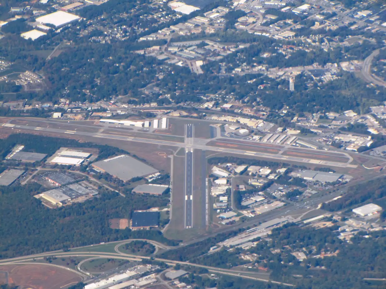
Lee Gilmer Memorial Airport and I-985 Exit 20 (Queen City Parkway and Candler Road), with rail spurs and mapped industrial land.
Source: OpenStreetMap, checked Oct 19, 2026 · Directions
-
Oakwood around I-985 Exits 16 and 17 (Mundy Mill Road and Atlanta Highway), home to the University of North Georgia's Gainesville campus.
Source: OpenStreetMap, checked Oct 19, 2026 · Directions
-
Flowery Branch and the Exit 12 to 14 area (Spout Springs Road, Martin Road and H.F. Reed Industrial Parkway), where the Falcons headquarters sits.
Source: OpenStreetMap, checked Oct 19, 2026 · Directions
-
South Hall where it meets Braselton and Buford (GA 211 and GA 347), around NGMC Braselton. Part of this edge lies outside Hall County.
Source: OpenStreetMap, checked Oct 19, 2026 · Directions
-
Georgia Ports Authority inland rail terminal east of the Norfolk Southern tracks along White Sulphur Road, linked by rail to the Port of Savannah; WSB-TV reported it opened May 4, 2026.
Address: White Sulphur Road, Gainesville area, GA (no street number published)
Source: Hall County, checked Oct 19, 2026 · Directions
-
City-owned general aviation airport run by Gainesville Public Works, with runways of 5,500 ft (5/23, ILS) and 4,001 ft (11/29).
Address: 1137 Aviation Way, Gainesville, GA 30501
Source: City of Gainesville, checked Oct 19, 2026 · Directions
-
Northeast Georgia Health System's Gainesville hospital campus on Spring Street NE.
Address: 743 Spring Street NE, Gainesville, GA 30501
Source: Northeast Georgia Health System, checked Oct 19, 2026 · Directions
-
Northeast Georgia Health System's Braselton hospital at River Place (Braselton mailing address; OSM places it outside the Braselton town boundary, in Hall County).
Address: 1400 River Place, Braselton, GA 30517
Source: Northeast Georgia Health System, checked Oct 19, 2026 · Directions
Run your own use through Corridor Fit, then read the corridor guides for Oakwood and Flowery Branch and the Inland Port and GA 365. For the zoning side of an industrial search, start with the industrial and warehouse guide.
Questions people ask
What are the I-985 exits in Hall County?
OpenStreetMap ramp and signage tags show Hall County interchanges at Exits 8, 12, 14, 16, 17, 20, 22 and 24. Exit 14 serves H.F. Reed Industrial Parkway to the west and Martin Road to the east.
Source: OpenStreetMap, checked Oct 19, 2026
Is GA 365 at White Sulphur Road an interchange?
No. The GA 365 and White Sulphur Road crossing is mapped as a signalized at-grade intersection, not an interchange.
Source: OpenStreetMap, checked Oct 19, 2026
Where does I-985 start?
I-985 begins at I-85 Exit 113 in Gwinnett County, per OpenStreetMap tags on the carriageway leaving I-85.
Source: OpenStreetMap, checked Oct 19, 2026
When did I-985 Exit 14 open?
The Gainesville Times reported that the Exit 14 bridge over I-985 opened to traffic on January 30, 2020, making the whole interchange operational.
Source: Gainesville Times, checked Oct 19, 2026
What does GA 365 connect to north of Gainesville?
North of Exit 24, the ramps onto northbound I-985 are signed for US 23 North and GA 365 North toward Clarkesville and Cornelia.
Source: OpenStreetMap, checked Oct 19, 2026
Written by the Gainesville GA Commercial Real Estate Editorial Team. AI tools help us draft; people check every fact against its source before it publishes.